GeoSLAM ZEB Revo RT Mobile Scanner

Scan, process and track progress as you go, viewing the point cloud in real time

Mobile scanning technology for quick, easy, and accurate geospatial measurements. The ZEB Revo RT is a mobile SLAM solution, with real-time data processing. Watch a scan unfold as it takes place on a user-friendly interface, ensuring that nothing is being missed during the mapping process.

The ZEB Revo RT is an ideal solution for indoor or underground data capture, of small to medium size spaces. Hard-to-reach areas like vents, manholes, shafts, or dropped ceilings become obtainable with a range of accessories, including the pole and cradle. Open ZEB Revo RT data in GeoSLAM Connect, a simple-to-use software with a range of automated workflows, helping to make sense of captured data.

Schedule a Live Demo
  • Value
  • Features
  • Versatility
  • Applications

Business Value of GeoSLAM ZEB Revo RT

Transition through Environments

Seamlessly transition through an area using handheld LiDAR, capturing entire datasets in one go. From interior to exterior, or stairwell to corridor, walking and mapping are made easy with SLAM devices.

Map Hard to Reach Areas

Better understand spaces by capturing hard-to-reach sections of an area. The versatility of mobile LiDAR provides opportunities to lower a scanner into vent shafts or elevate into ceiling voids, without the need for risking user’s safety.

Capture Data Faster

The lightweight nature of a mobile SLAM device unlocks the potential for faster data capture. There isn’t a requirement for multiple setups to provide a desired outcome. Users simply need to switch on the scanner, walk and scan simultaneously, and return to their beginning point.

Repeat Scans as Often as Needed

The ease-of-use mobile scanners provide leads to anybody being able to map an area quickly. The process is repeatable as often as every day, if needed, leading to frequent and up-to-date data for all stakeholders, for more informed and faster decision-making.

It’s Not Just About Data Capture

Data capture is just one component of many workflows. What happens to that data and how information is extracted is equally, if not more, important. A solid software platform, like GeoSLAM Connect, provides the means to process data quickly and offers an array of automated pre-built workflows – such as change detection or floor slices — allowing users to make the most of the data they collect.

Take GeoSLAM Data Further

Following initial processing and analysis, point cloud data can be taken into a range of third party software to make further enhancements and to complement any pre-existing workflows.

Complement Other Forms of Data Capture

Combining SLAM systems with other LiDAR solutions, like the FARO Focus, offers a complete data capture package for an accurate, fast, and repeatable way to obtain point cloud data.

ZEB Revo RT Features


  • 43,000 scan points per second
  • Up to 6mm relative accuracy
  • Up to 30-meter range
  • Real time data processing
  • Accessory options to enable an enhanced data capture experience

One handheld 3D scanner, so many ways to use it.

Real-time

Available with real-time data processing, the ZEB Revo RT allows you to track your progress as you scan. It is the ideal, easy-to-use tool to gain real-time insight into your scans and to see your point cloud being created as you walk.

Cradle

Capture hard-to-reach areas like manholes, vertical shafts, or sinkholes by attaching the ZEB Revo RT to the cradle or guard and lowering it into the spaces. The rugged guard protects the scanner from damage, whilst lowering it into potentially volatile environments.

Pole

The strong carbon fiber pole provides a way of safely elevating the ZEB Revo RT to capture data from difficult-to-access areas like ceiling voids, stockpiles, or for infrastructure inspections.

ZEB Pano

Enhance property surveys with the ZEB Pano by complementing point cloud data from the ZEB Revo RT with 360o panoramic photography. The ZEB Pano is an ideal way to digitize the surveying and property marketing process.

ZEB Cam

Add contextual video and imagery to the ZEB Revo RT data with the ZEB Cam. Apply texture information to the point clouds and mesh, using the camera imagery. Utilize optical flow technology to accurately synchronize the video and scan data together.

Mining: Capture Stockpile accurately for volumetric data calculations

Simply walk and scan stockpiles using the ZEB Revo RT to capture relevant data needed for the calculation of the volume. Capture stockpile data as frequent as necessary, providing a fast and accurate turnaround for stakeholders. The ZEB Revo RT is a simple-to-use scanner, so hardware training for new staff is minimal. The information gathered can be processed and analyzed in GeoSLAM Connect and GeoSLAM Volumes.


Real Estate: Map Properties Quicker for the Creation of Floorplans

Seamlessly transition from room to room in a property using the ZEB Revo RT to capture all the internal data required for creating accurate floorplans. Provide a service that requires minimal effort for data capture, doesn’t disrupt residents or businesses, provides a fast cost-efficient service and a great return on investment. Use GeoSLAM Connect’s automated Floorslices workflow, to slice through the individual floors from the dataset, leaving a precise image of the floorplan ready for modelling.


Construction: Review Changes Over Time Frequently

Ensure your construction projects remain on track by reviewing changes over time. SLAM provides a method of data capture so fast and accurate that analysis of progress is viable monthly, weekly or even daily, without disruption to daily activities. Avoid heavy fines and provide all stakeholders with concrete updates on the progress of the build, as often as needed. Use the change detection workflow in GeoSLAM Connect to automate this process, with easy-to-understand PDF reports.
Revo RT Construction
Case Study

3D Scanning Construction and Demolition Waste
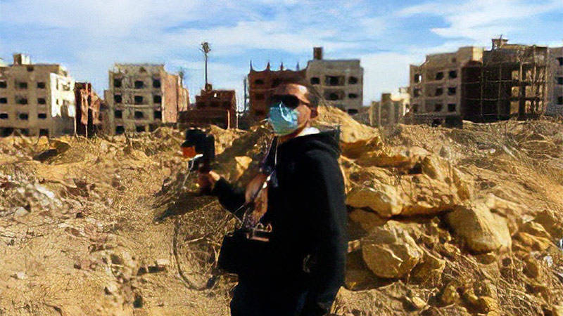
Learn how the Egyptian government mapped the increasing construction waste piles in the country and quantified waste volumes using mobile LiDAR.
Revo RT Real Estate
Case Study

Creating Measurement Reports for the Real Estate Market using SLAM technology

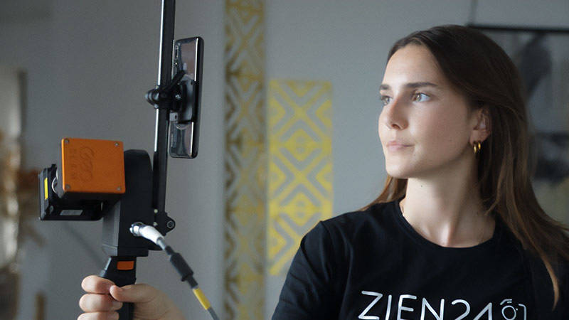
In light of regulations, Rotterdam based media and marketing company, ZIEN24 chose GeoSLAM to allow them to capture error-free data and high-res photos for residential and commercial properties.

Related Products

GeoSLAM Geospatial Technology

Mobile 3D data capture for mapping and understanding hard to reach spaces.

FARO Focus 扫描仪

FARO Focus Premium 三维激光扫描仪帮助您自信地捕捉建筑物和复杂环境的精确测量结果

Ready to see how the GeoSLAM ZEB Revo RT Handheld SLAM Scanner can benefit your projects?

Schedule a Demo